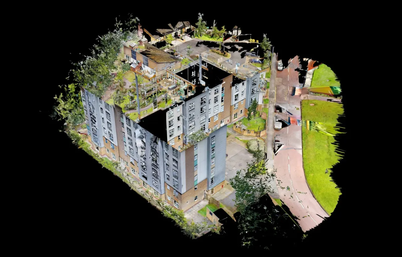
LiDAR 3D scanning for surveying existing buildings and using the imagery collected for BIM conversion
Leading the way in providing the complete approach to fire safety, passive fire protection, compartmentation, and fire engineering with 2D Floor Plans and 3D LiDAR Scanning.
The digital scanning platform lets Global turn any space into an accurate and immersive digital twin which can be used to design, build, operate, and promote any space.
Avoid the pitfalls
Global Group have an in-house LiDAR scanner. It is used to undertake surveys of existing buildings, geotag locations of remedial work requirements which fail to comply with building regs and enables the team back at the office to view each site as a team and combine expertise.
- 3D Mapping and FRAs
- 3D Mapping and PAS9980
- 2D & 3D Fire Mapping Latent Defects / Legacy Survey for Fire Safety
- Pre construction fire survey
- Post construction fire survey
- Golden Thread Fire Mapping


Site 3D Virtual Tours & Surveys
Using a LiDAR scanner allows users to remotely ‘walk’ through their site. Our clients count on virtual walkthroughs for inspection purposes, validation of as-built conditions, remote monitoring and latent defect claims. The scanner also give users the ability to remotely measure length and depth to a high accuracy.
Global Building Environments can scan to BIM service using point cloud data to create an Autodesk Revit model. Talk to our sales team about our Mechanical, Electrical, and Plumbing (MEP) services based on your project needs.